City of Bainbridge Island PLUS
-
 Road IssueOpenNe Koura Rd & Miller Rd Ne Bainbridge Island, WA, 98110, USA - Bainbridge IslandMiller and Koura remains a dangerous intersection, both for drivers trying to cross or turn onto Miller and especially for pedestrians trying to cross Miller without getting killed. As has been pointed out several times before, Miller (not North Madison) has become the de facto second North-South "305" for contractors, commuters and the growing island population. Although speed limits have been reduced on Milller, THERE ARE NO SIGNS NEAR THIS INTERSECTION, so drivers naturally speed back up to 40, 45 or 50 MPH through here. Ideally, this should be a 4-way stop. Minimally, signage needs to be put up near the intersection to slow drivers down and protect lives. Please address this before somebody is hurt or killed.
 -
 Road IssueOpenLynwood Center Rd Ne & Ne Opal Ridge Ln Bainbridge Island, WA, 98110, USA - Bainbridge IslandThere is a large, quite noticeable large/tall tree just off the road (Lynwood) that is very dead. It is an area where a sail boat is often stored (not currently there). The tree is an accident waiting to happen. Should it fall either easterly or southernly it is sure to take out power lines. Would recommend the tree be removed prior to the fall/winter storms.
 -
 Road IssueOpen10791 Sunrise Dr Ne Bainbridge Island WA 98110, United States - Bainbridge IslandThis segment of Sunrise has deteriorated significantly, making an extremely uneven surface for driving, walking, and biking. This is a highly trafficked road with many using it for their walks, including the parks department community walk group. The surface is so poor is dangerous to drive and I've seen bikers get injured on the uneven surface. This needs to be repaved as part of the yearly resurfacing program.
 -
 Road IssueOpen6501-6503 Ridge Ln Ne Bainbridge Island, WA, 98110, USA - Bainbridge Island
The section of NE Bucklin Hill Rd between Ridge Ln NE and Fletcher Bay Rd NE (that runs along the sand pit) was striped with a yellow stripe at some point in recent years.
Since then, the intersection of Lynwood Center Rd NE, Bucklin Hill Rd, Bucklin Hill Rd NE and Ridge Lane NE has become more dangerous. It's our feeling that with the new stripe on the portion of Bucklin that runs along the sand pit, it's now unclear to drivers (especially non-locals) as to which road is the arterial, and which is the side-street (Bucklin or Lyn Cntr). Previously, it was obvious the arterial was Lynwood Center Rd, because that section of Bucklin wasn't striped. We suspect that drivers approaching the intersection from the west, heading east on Bucklin along the sand pit, are getting confused. We are concerned that eventually there will be an accident here, likely a head-on when a driver heading east on Bucklin proceeds thru the intersection, expecting a driver heading west on Bucklin (directly at them) to go straight - when in fact that west bound driver will follow the arterial on Lynwood Center Rd, turning directly in to the other driver and colliding head on. This nearly occurred with my wife driving last night. She only avoided a head on collision with the east bound driver by slamming on the brakes at the last moment, just as she was beginning to round the turn on to Lynwood Center Rd. A reminder we should signal at that fork, when we didn't need to before.
Also, I cycle along here every day and have for 10 years. I've noticed that since the stripe was painted, cars coming behind me, west bound on Bucklin passing the fire station, will not always expect me to follow the curve of the arterial road. From their vantage point, with the new stripe, especially at night, it looks like the road just goes straight past the sand pit. As an experiment, try standing in front of Hyla at night looking west. You'll see it looks like the road just goes straight. If I wasn't a native I'd almost for sure proceed straight along the sand pit. So, from their perspective I am suddenly and unexpectedly veering my bike in to the lane in front of their car. I had 3-4 close calls before I realized I need to bike in the center of the road, taking the lane (blocking the cars behind me), and signaling with my hand, to deter this from happening.
Anyway, I hope you can take a fresh look at that intersection.
Thanks for all you do!
Best,
Alex Greene -
 Code Enforcement IssueAcknowledged6641 Wing Point Rd Ne Bainbridge Island, WA, 98110, USA - Bainbridge IslandI flagged this a couple of years ago and it was just closed without correction without allowing further comments or a way to respond. This is a road end which should allow public access to the view point, but there is a gate across it. The gate should be removed and public allowed to get to the viewpoint.
 -
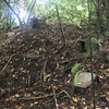 Road End IssueAcknowledged10994 Ne Mountain View Rd Bainbridge Island, WA, 98110, USA - Bainbridge IslandHeavily used dirt trail between the end of NE Mountain View Rd, and Ocean View Drive (on City ROW, I believe?), there is all kinds of discarded sheetmetal, cast iron framework(very large), electrical conduit, piping etc laying on slope. Appears cast over from Messenger House facility over the years, and never removed, and dumped legally. Very unsightly, not becoming of the neighborhood. Please get someone responsible to immediately remove. Also see Architect Response 7.17.2020, to neighbor questions under PLN51717-CUPA. Again, appears to be responsibility of Messenger House. Pics do not show all the material discarded over slope and down to trail route. Thank you.
 -
 Road End IssueAcknowledged5842 Main St Ne Bainbridge Island, WA, 98110, USA - Bainbridge IslandThe owner of Eagledale Moorings Mr. Richard Burke has been storing his dumpster on this road end for well over a year. This dumpster is not even on his property and is impeding our use of the road end. Thank you.
 -
 Road End IssueAcknowledged6337 Ne Hidden Cove Rd Bainbridge Island, WA, 98110, USA - Bainbridge IslandHidden Cove Road End is VERY muddy where road end users walk,bicycle or park to go to beach. COBI heavy equipment tracked the mud today. Please gravel at least the parking area as road end use will soon be increasing in warmer weather, by pedestrians, bicyclists and vehicles.
 -
 Road End IssueAcknowledged1121 Irene Pl Ne Bainbridge Island WA 98110, United States - Bainbridge IslandThe WA state ferries wetland mitigation property and BI road end/Waterfront Trail has illegally slashed willows and destroyed wetland plants. These were slashed one year ago, city engineering and code enforcement investigated.please have wetland specialist investigate as well as repeat offense.
This is a repeat offense. Please investigate and have wetland plants restored. -
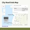
Road End IssueOpen3776 Lytle Rd Ne Bainbridge Island, WA, 98110, USA - Bainbridge IslandFurther clarification is required regarding parking access along Lytle Road NE, specifically at the public road end. The available roadside spaces—excluding those within 'No Parking Between Signs' zones—seem to be open for use by any driver. Should there be restrictions exclusive to street residents or other limitations, appropriate signage must be installed to guide visitors seeking parking. Additionally, it should be communicated to the homeowner at 3776 Lytle Rd NE that these spaces are public, as the current lack of clear signage may have contributed to misunderstandings. The residents at this address have engaged in hostile behavior, including verbal harassment and the placement of threatening notes directed at individuals parking in these spots. Moreover, there have been instances where personal items like buckets and crates were used to obstruct these parking spaces when unoccupied. Immediate action is required to address these violations and ensure that public parking spaces are accessible to all drivers without interference or threat to personal safety.
-
 Sign IssueAcknowledged16001–16075 Euclid Ave Ne Bainbridge Island WA 98110, United States - Bainbridge IslandThere is no sign to indicate that this is a PUBLIC road end beach access. A brown sign should be added, as I've seen at other public road ends at beach, to indicate the access is NOT private. Adjacent to this area and along the street are several signs indicating the beach is private to the Port Madison community..therefore a sign declaring this particular access as public is highly needed to avoid confusion with the private signs...
 -
Sign IssueAcknowledgedNe Day Rd E & Wa-305 Bainbridge Island, WA, 98110, USA - Bainbridge IslandThe intersection of 305 and Day road is littered with commercial signs. These road islands were designed by the DOT for traffic safety and direction not as free ad spots. Peds and bicyclists are obscured, drivers are distracted and safety is compromised for the sake of advertising. These public areas are about safety not sales. Please remove the signs before (or more) accidents occur.