Bike East Bay
Alameda + Contra Costa counties, bicycle issues only
Notified About
-
55th Street And Dover Intersection Oakland, California - BushrodA crosswalk has been needed for years at the intersection of 55th Street and Dover, between MLK and Shattuck Avenue. Cars drive at advanced speeds and pass other cars since the street is quite wide (even with the addition of the bike lanes neighbors suggested). Due to its location between several freeway on and off ramps, along with the street's width, drivers treat this stretch of road as a freeway extension. At the residential intersection of 55th and Dover, residents and neighborhood visitors and Children's Hospital Oakland employees (often children and seniors) routinely cross to reach the hospital, the popular Dover Street Park (@Dover/59th), the North Senior Oakland Senior Center, CHORI, and the bus stops (two well-used AC Transit lines run down 55th Street) on either side of the street. Although not a formal bike route, Dover Street is also heavily utilized by bicyclists. Crossing for pedestrians and bikers is often an impossible task due to the lack of signage and a steady stream of speeding cars (some passing other cars in the oncoming lane at even higher speeds). It is particularly difficult to cross during the winter, when residents coming home from work must disembark from buses and try to cross the street after dark (and sometimes in the rain). Pedestrians, bicyclists, and drivers would benefit greatly from a large reflective thermoplast crosswalk and reflective signage at 55th/Dover to alert drivers to the presence of pedestrians (particularly children and seniors) for whom they should slow down.
-
56th And Adeline Oakland, California - Santa Fe
Adeline Street in Oakland from the Emeryville border north to 61st Street is being repaved and re-striped with a road diet and buffered bicycle lanes (great!), but no new marked crosswalks are being added along this entire stretch as part of the project, even though they are warranted by the city's own design policies (See http://www2.oaklandnet.com/oakca/groups/pwa/documents/report/oak025058.pdf).
The city's crosswalk decision matrix recommends marked crosswalks be installed when there is a gap between existing crosswalks of 900 feet or more. The existing gap between the marked crosswalks at 54th and Market is over 1100 feet and the gap from Market to 61st is over 1600 feet.
As such, I am requesting that three new crosswalks be striped across Adeline at 56th, Arlington, and 59th Streets. None of these streets are skewed or T intersections, so no parking spots will need to be removed or curb ramps will need to be added in order to stripe the crosswalks there. The crosswalks can either be at the north or south leg of these intersections (or both), based on sight lines or other design criteria.
-
2219-2399 Wood Street Oakland, California - ClawsonSeveral neighbors have fallen on their bikes on this street, as it still contains embedded tracks parallel to the direction of traffic, and questionably in the middle of the road. There are zero traffic markings, so it becomes double dangerous, as cyclists (or motorists!) must guess the intention of oncoming traffic, as to where they believe the left- and right-hand lanes should be. This road needs decades-since-active rails removed, a resurfacing, and better traffic markings. As this neighborhood grows, Wood Street has great potential to be bike boulevard, connecting Oakland residences to Emeryville (and Oakland) businesses.
-
Ineffective traffic signal AcknowledgedHigh St & International Blvd Oakland, CA - South Kennedy Tract
If anyone's ever tried to take High Street between, say, Maxwell Park or the Laurel to 880 or Alameda during the day, especially about 2-7pm, knows this horrific backup.
Here's the situation: There are two lanes of traffic in each direction, no left turn lanes, no median barrier, no bike lanes, sidewalks abutting lanes of traffic (ie, no room to widen the street). The traffic light is on the simplest cycle imaginable: green for International, green for High, repeat.
When the light turns green for High Street, traffic in the left lane almost invariably wants to turn left, and has to yield to oncoming traffic, blocking the left lane for most of the cycle of the light. Meanwhile, traffic in the right lane has to yield to the high volume of pedestrian traffic in the neighborhood, which can easily block the right lane. It is not uncommon for traffic to only be able to advance a couple of car lengths per green. To make matters worse, few drivers signal their intentions to turn, at best at the last second when it is too late to get out of their lane!
While I don't expect any progress on Oakland driving etiquette, A left turn lane would alleviate a lot of this traffic. Perhaps signs at Courtland and 880 advising through traffic to take SR 77 (42nd Avenue).
Here's my ideal situation for this intersection: approaching International on High (in either direction), there would be, from right to left, a right turn lane, a through traffic lane, a left turn lane, and the opposing through traffic lane, coupled with signalized left turns, in all four directions (there is already a left turn lane on International, but no separate signal phase). This geometry involves some slight weaving in the intersection, but only about as much as there currently is at High and Foothill. Of course, it means that technically, this would create a bottleneck as two lanes in each direction merge into only one, but one lane that actually moves would be a remarkable improvement over none!
I have to drive this stretch of road multiple times a day, and I just can't believe how long this dysfunctional intersection has remained unchanged. Thank you!
-
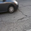
Chatham is a failed street Acknowledged1362 Chatham Road Oakland, CA - GlenviewChatham Rd is the onramp to 580 West in this area. Chatham is a failed road. It is full of potholes. Many potholes are filled, but the road is still in extremely bad shape. It is dangerous for bicycles. This section will damage car tires.
-
1637 16th Street Oakland California - Prescott Oakland PointLarge (3-4" high) bump in road. Has been here for 10+ years. I have seen at least 5 bicyclists fall off their bikes and injure themselves and their bikes by hitting this bump/buckle in the surface of the road. Cars are also hitting the road after hitting this large 'natural' bump.
12 February 2019 -- STILL THERE (15 YEARS AFTER FIRST REPORTING) - Yet another person went flying head first off of their bicycle the other night. -
HOMELESS ENCAMPMENT = SAFETY ISSUE Acknowledged3529 Peralta Street Oakland, California - Clawsonthe homeless encampment under the freeway has grown 3x it's size in the last month. the tents/pallets/bikes/trash are overflowing into the street. sidewalks are blocked for both pedistrians and are not accessible for the disabled. open air drug dealing and prostitution. mattresses. despite porta-potties, human feces and urine fill the area. horrendous smell. needles strewn. starting to block traffic.
-
HOMELESS ENCAMPMENT/ Biohazard waste Acknowledged42nd And Mlk Oakland, CA - LongfellowSeveral older African American homeless men living in tarps/ tents and home made cardboard homes with a gas stove, human waste and broken glass, and what appears to be SEVERAL stolen tools & various bikes from nearby homes and oakland residents!
-
Driver Plaza Oakland, California - Santa FeDriver Plaza needs help from every city agency. It is frequently the site of all-day drinking fests, the trees are dying from the daily, constant urination by the drunks who party there, and the tree planters are giant garbage cans where the drunks throw their cigarette butts, liquor bottles, needles, cans, and other nasty garbage. The bus stop glass is frequently shattered by drunk, angry people. Families try to walk their dogs and children through the gross mess and cyclists try to navigate this bike corridor without getting flats from all the broken glass.
-
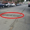
Pothole Archived3322-3344 Butters Drive Oakland, CA 94602, USA - WoodminsterEndangering gas line & water line and bikers. Now 20 ft long, 18 in wide, 3.5 in deep, with sharp edges.
-
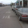
2501-2549 West Street Oakland, California - Hoover-FosterWest Street between 25th Street and Sycamore St has bike lanes on it, only the line marking the lane is gone. On much of West street new paint was applied this summer (thank you!) to refresh the thermoplastic but this block was missed. There is an existing "bike lane" stencil in the north bound direction, but the stripe marking the lane is no longer visible on either side of the street.


